The i-Tool gives you the ability to click anywhere on a map to get more detailed information about that map point.
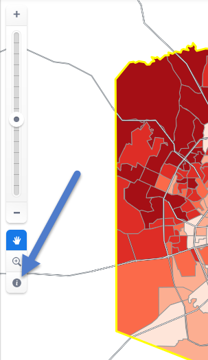
The cursor changes to a question mark and you can now click anywhere on the map to get more detail. The active geographic unit, specified in the Legend, will determine what type of location is selected when you click (e.g., block group, census tract, ZIP code, county, etc.).
Click a specific location on the map and you’ll see a new selection box appear with information and options:
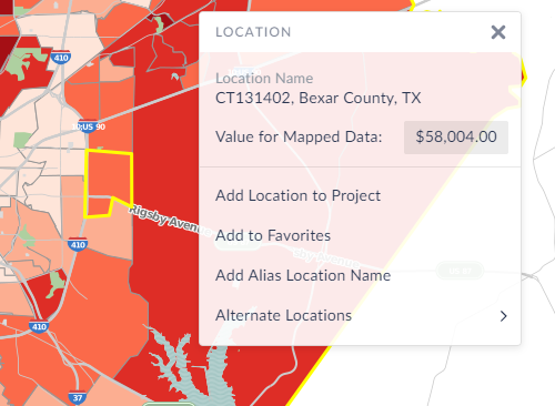
Browse the alternative locations/view data to see what other geographic units apply to this point or:
- Add Location to Project: The map view will focus in on the location, and it will be added to your Project.
- Add to Favorites: Adds the clicked location to your Favorites for easy future access
- Add Alias: This allows you to rename the clicked location with a more familiar or recognizable alias, or nickname, and add the new alias to the Recent Locations list.