A census tract is an area roughly equal to a neighborhood. Census tracts are smaller than a city, but larger than a block group. The area is a small, relatively permanent subdivision of a county. The overall hierarchical presentation is shown below:
State
County
County subdivision
Place
Census tract
Block group
Block
Typically, the population of a census tract ranges between 1,200 to 8,000 people. The spatial size of census tracts can also vary substantially, based on the density of the area.
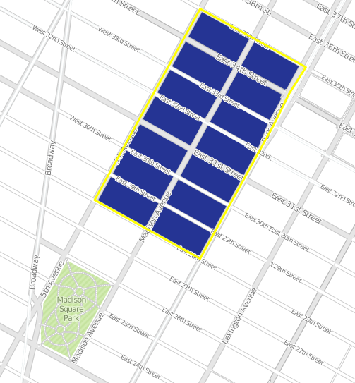
Below is an image of a census tract in Manhattan.

The primary purpose of census tracts is to provide a small stable set of units for the presentation of decennial census data.
Census Tract Codes and Numbers- Census tracts each have a unique number associated with it. The CT numbers can be up to four-digits long, and may have an optional two digit suffix (1475.02). Additionally, CT have codes that are six digits long and do not contain a suffix (although they would have leading 0's to make six digits- ex. CT number 45 would have a code of 004500) . The example above (number 1475.02) would be a code of 145702.
Sources:
United States Census Bureau, Geographic Terms and Concepts - Census Tract (https://www.census.gov/geo/reference/gtc/gtc_ct.html)
United States Census Bureau, Geographic Terms and Concepts - Geographic Presentation of Data (http://www.census.gov/geo/reference/gtc/gtc_geopres.html#hier)